JUST-Studio: A Platform for Spatio-Temporal Data Map Designing and Application Building
HANDBOOK
1. DEMONSTRATION (Video for Designing a Rout Planning Application )2. Standard Steps for Application Designing(Take geofencing for an example)Service Manager Register Data SourceCreate Data Model ST Application DesignerMap DesiningApplication DesigningShare and UseSave and shareUse by web pageUse by JUST-SDK
1. DEMONSTRATION (Video for Designing a Rout Planning Application )

2. Standard Steps for Application Designing(Take geofencing for an example)
Service Manager
Register Data Source
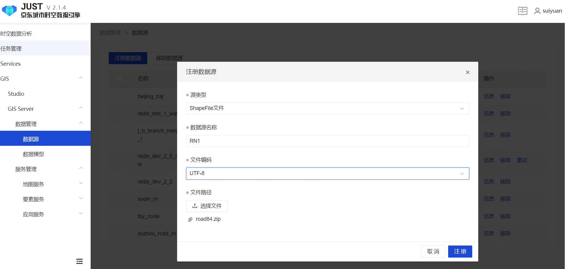
Register a shpfile data source to upload Road Network(simplify RN later) data.
Select Shpfile data source type, select local RN shpfile, set file encoder
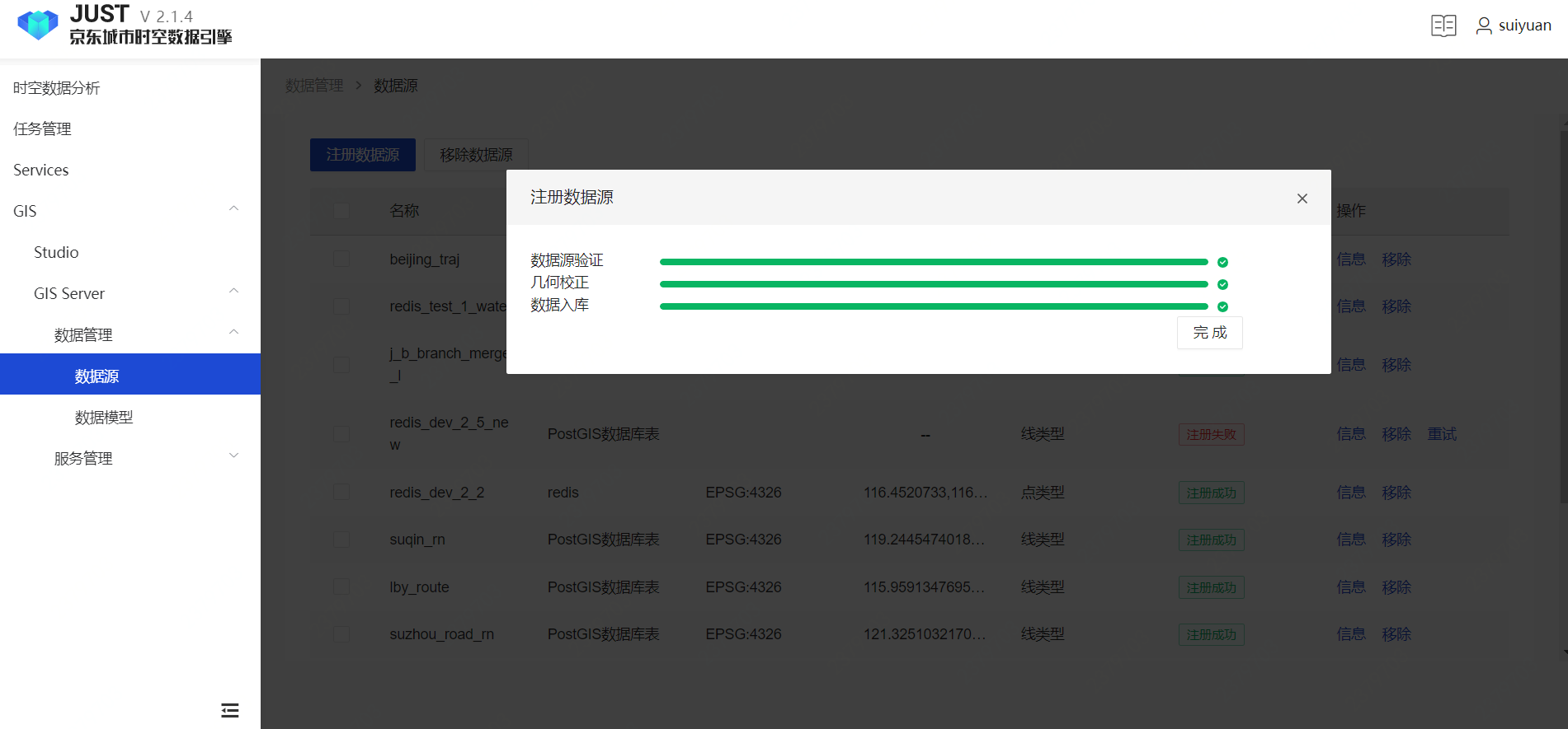
Validate file, uploading to server
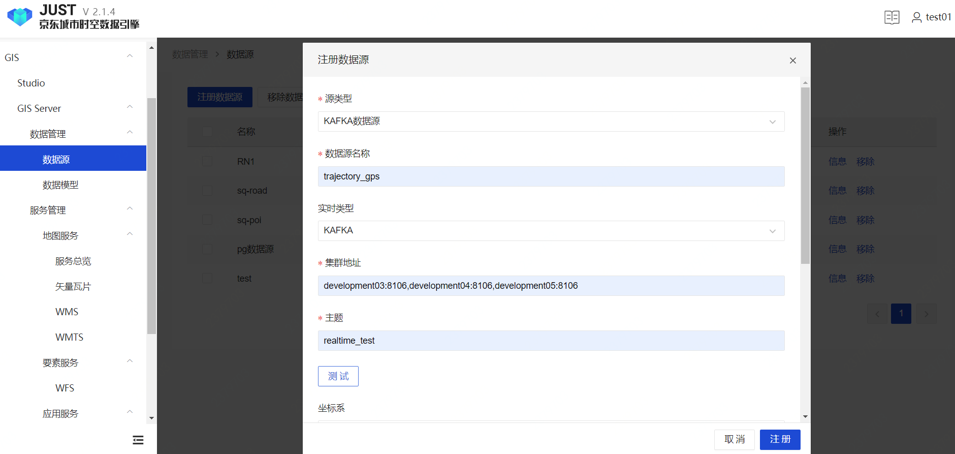
Register a Kafka data source to receive vehicle's real-time GPS points.
Select Kafka data source type, set Kafka server and topic
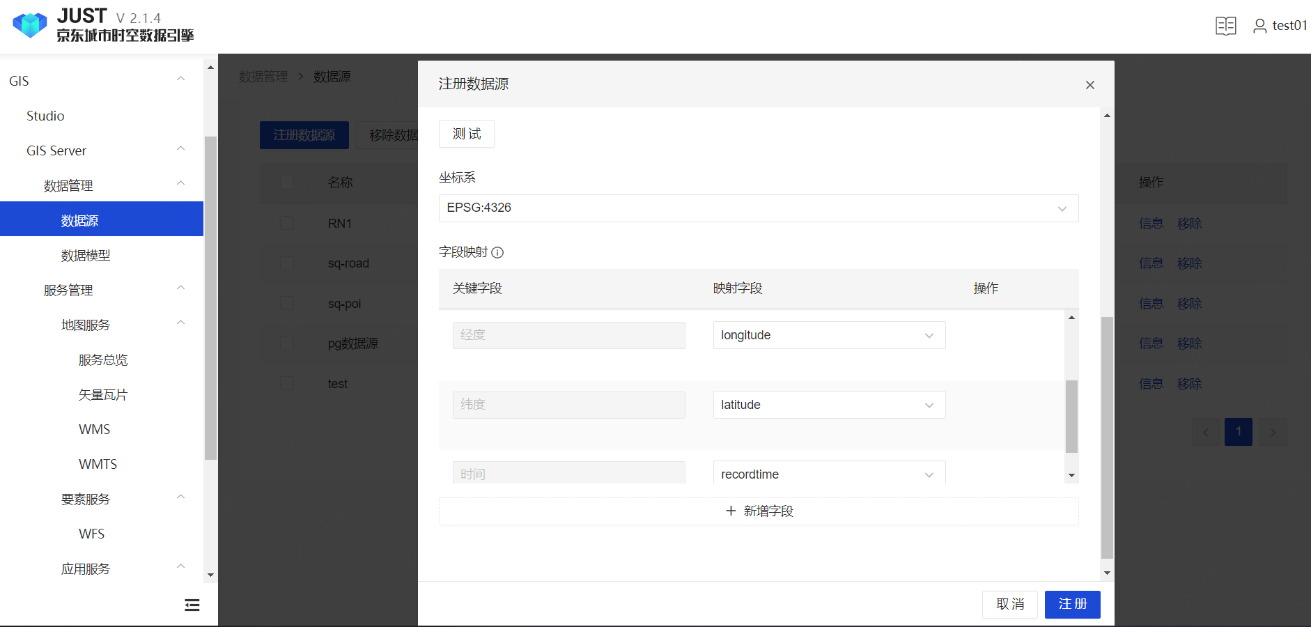
Validate the Kafka data source, then map the fields
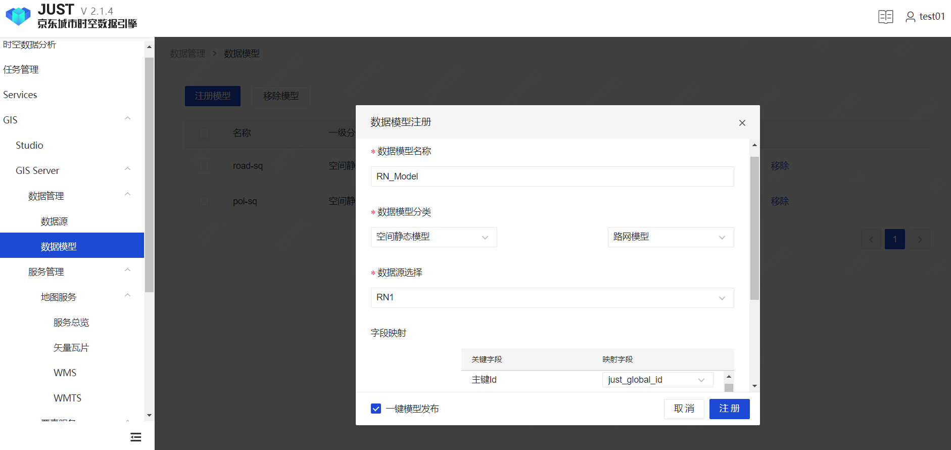
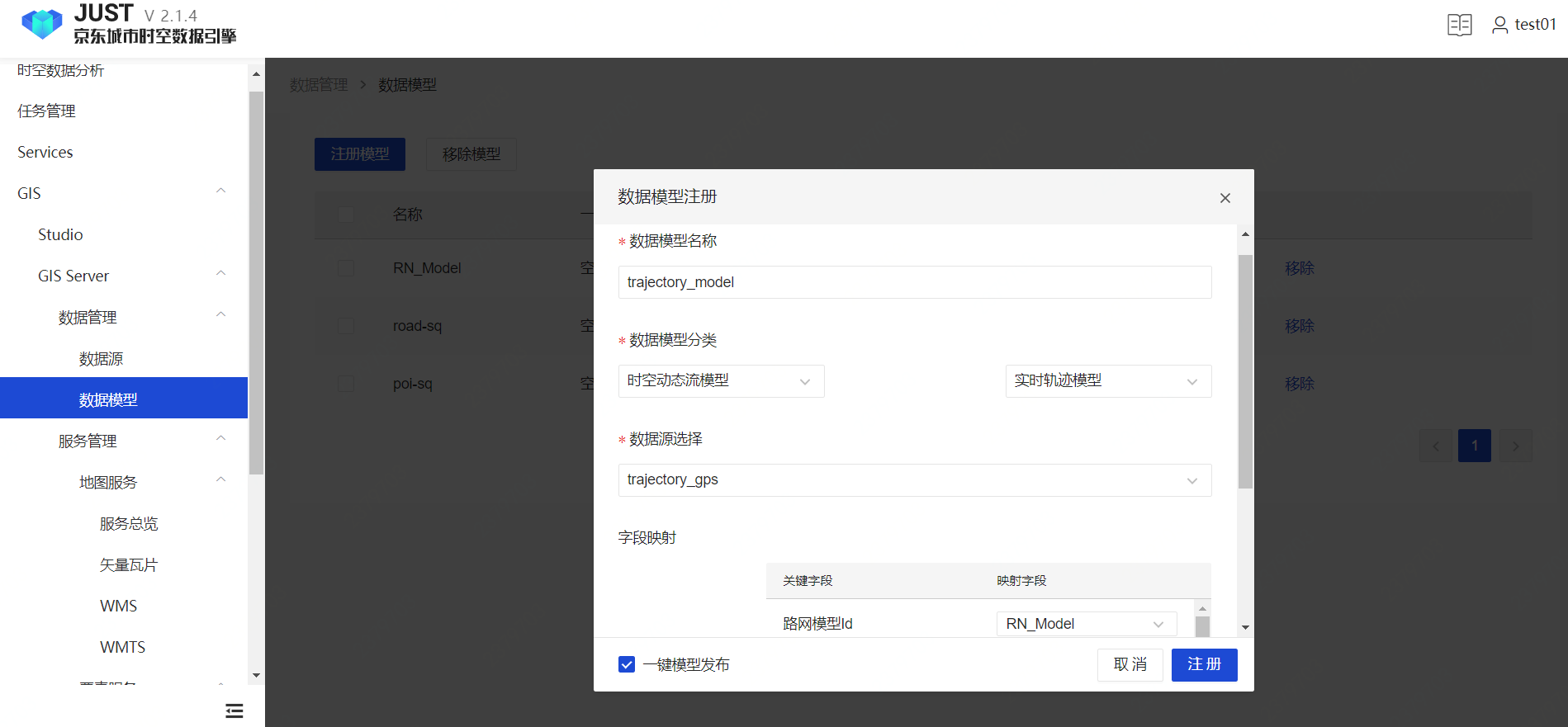
Create Data Model
Create Road Network model
Create Trajectory data model
ST Application Designer
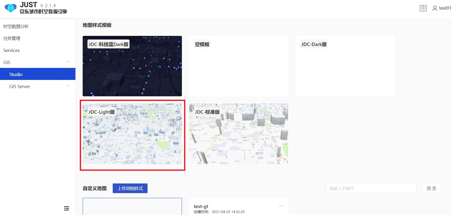
Map Desining
Select a template, entering designing workbench.
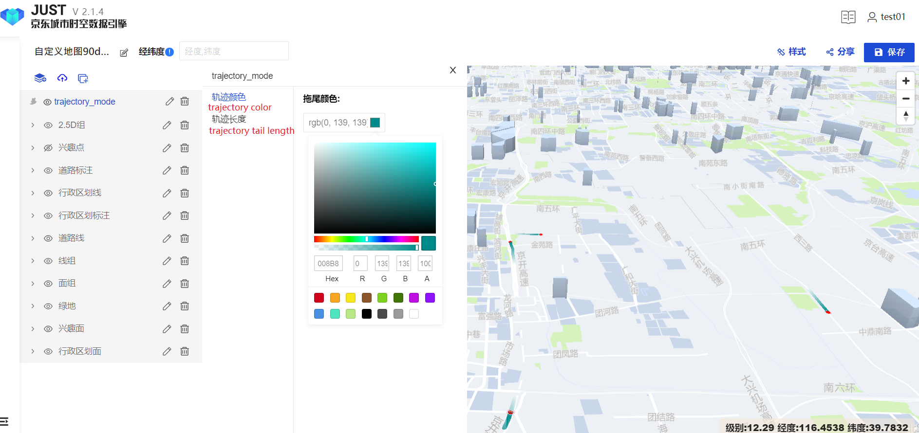
Add trajectory layer.
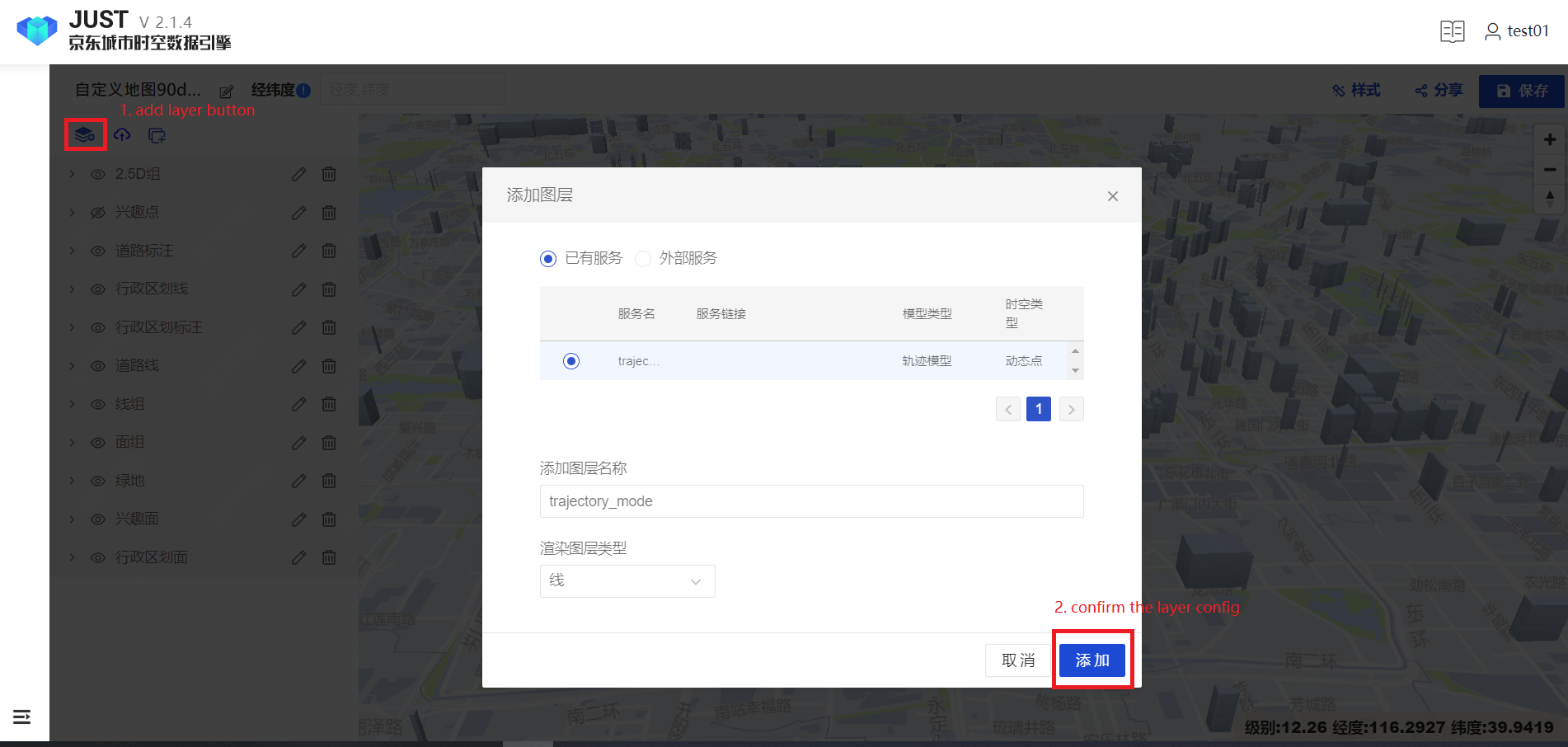
Set trajectory properties
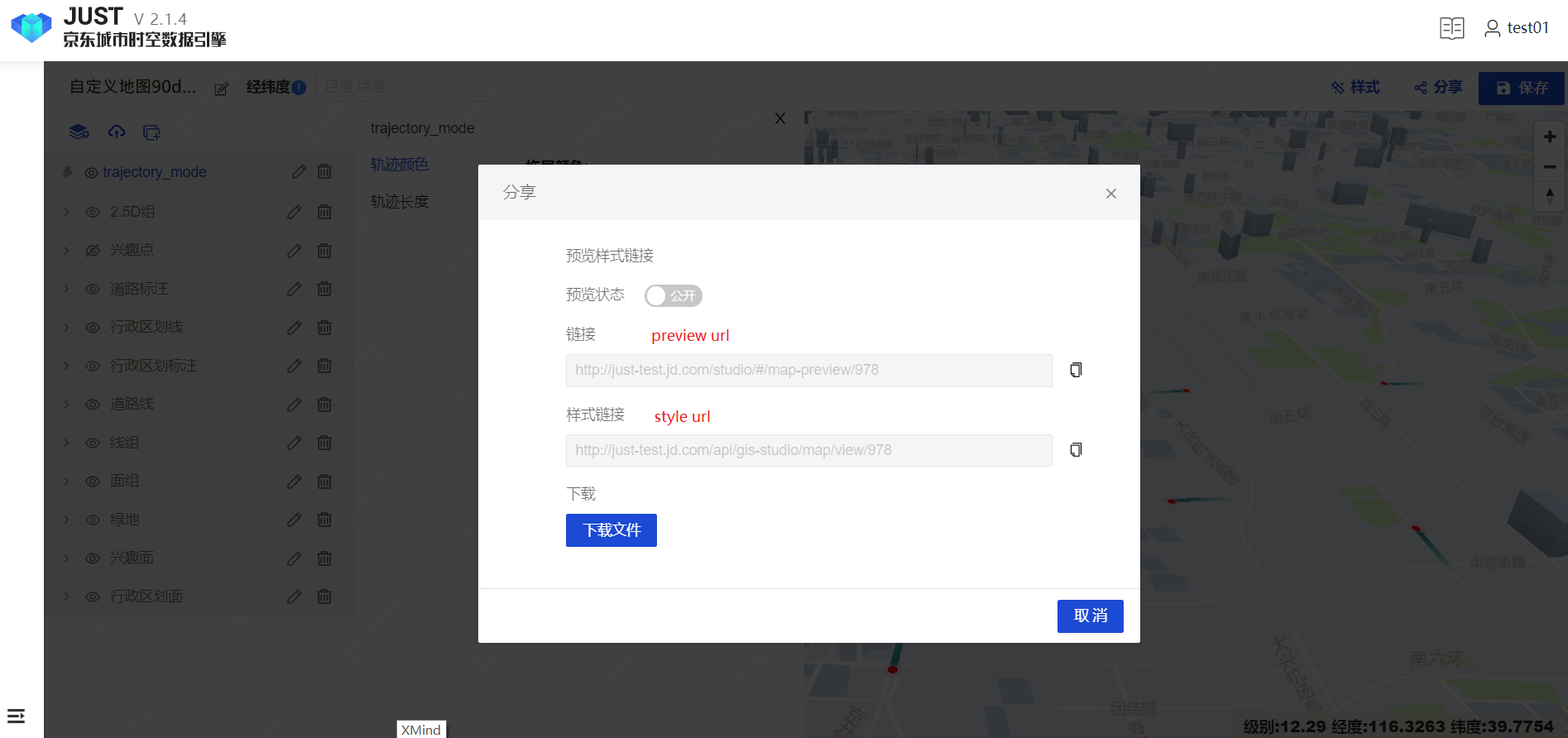
Save and Publish.
Application Designing
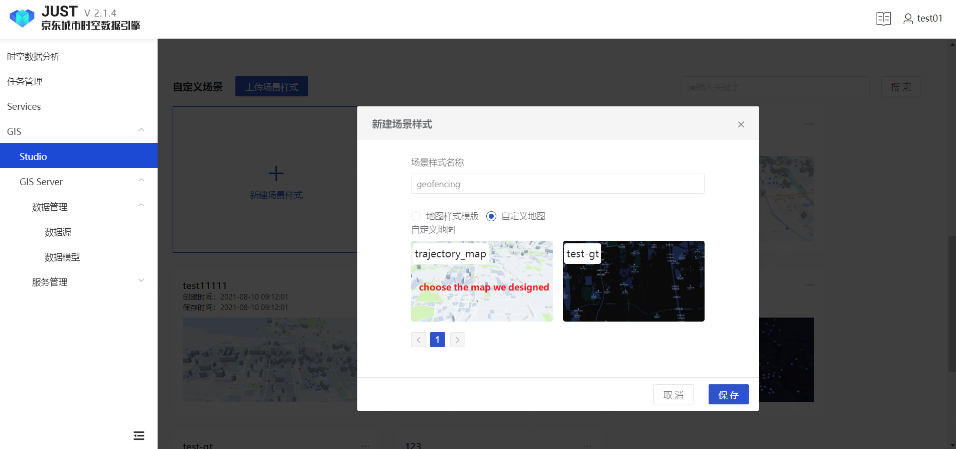
Choose the map we designed, entering application design workbench.
Design the application
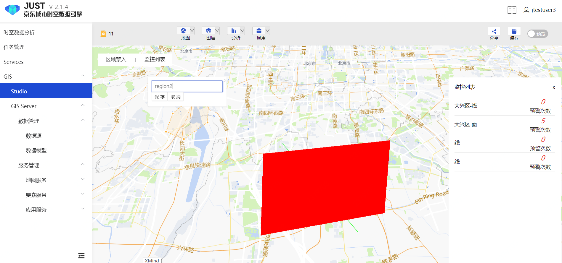
Add a Geofencing Control, then set the size and location, Associate a Geofence model, Preview.
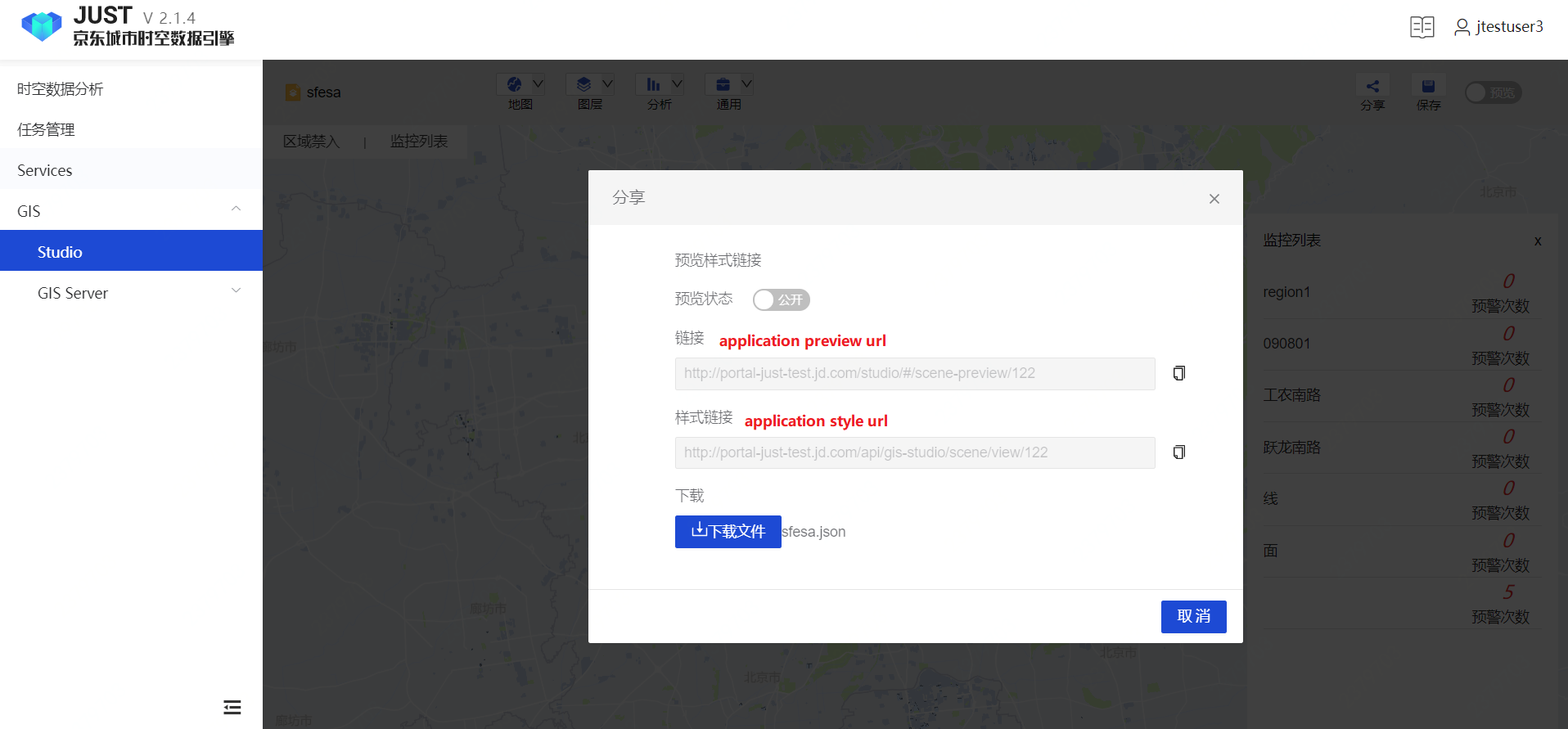
Share and Use
Save and share
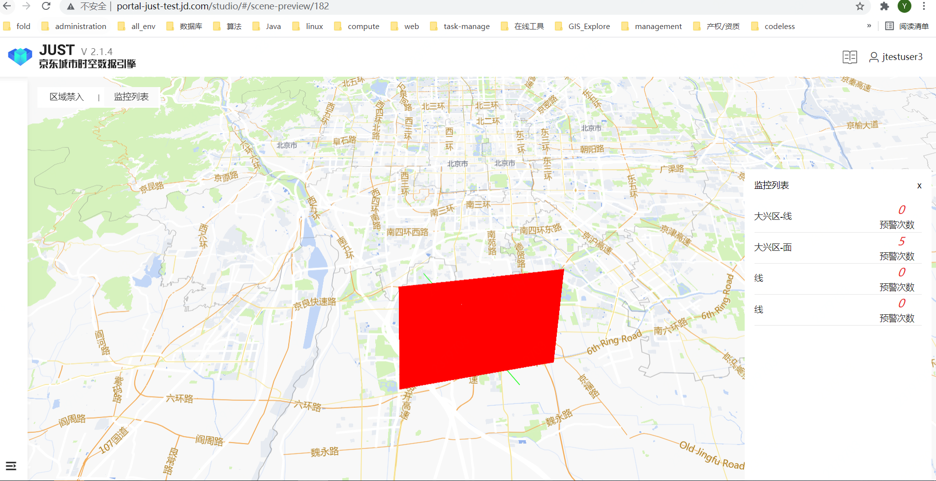
Use by web page
visit the url we published
Use by JUST-SDK
Insall sdk
Initialize application we designed
xxxxxxxxxximport React, { useRef, useEffect } from 'react';import { JustMap, JustSource } from '@jd/just-map';import scene from '../test/test-portal.json'
function App() {  const mapContainerRef = useRef();  const mapRef = useRef();  useEffect(() => {    mapRef.current = new JustMap({      style: scene,      mapboxOptions:{        container: mapContainerRef.current,      }    })  }, [])  return (<div    id="map-container"    ref={mapContainerRef}    style={{height: '500px'}}    >  </div>)}
export default App;